The county of Cheshire is awash with beautiful countryside perfect for walking. From forests to sandstone ridges, wild moorland to rolling pastures and canal banks to rural villages, the diverse Cheshire landscape has some great places to walk.
Best Walks in Cheshire
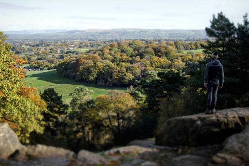
Listed below are the most popular hill walking areas and walks in Cheshire, so grab your backpack and let’s head for a wander!
- Shining Tor
- Shutlingsloe
- Delamere Forest
- The Sandstone Trail
- The Delamere Way
- White Nancy
- Helsby Hill
- Alderley Edge
Shining Tor
Shining Tor is the highest peak in Cheshire at 559m (1,834ft) above sea level. The hill lies between the towns of Buxton and Macclesfield, and is situated within the boundary of the Peak District. It occupies an upland position and has impressive views from the summit, which include the Cheshire Plain, Shutlingsloe (aka the Cheshire Matterhorn), the city of Manchester and on a clear day the mountains of North Wales.
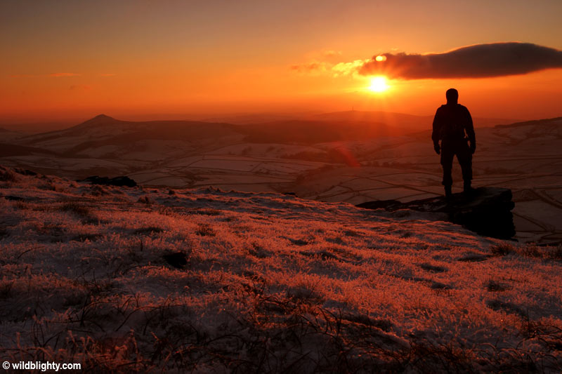
Shining Tor has a relatively small prominence meaning there are more challenging walks in the peak district to be had. That said who doesn’t want to bag the highest peak in Cheshire!
Shining Tor can be approached by different routes, for a short bimble its an almost flat 1.4 mile walk from the Cat and Fiddle Inn situated along the A537 Buxton New Rd. There is limited lay-by parking opposite the entrance to what was England’s second highest pub, and is now a Whisky distillery and cafe! A more challenging 6 mile circular route starts from Errwood reservoir, and includes the summits of Cats Tor and Shining Tor. Park at Errwood Hall Carpark and follow the below GPS route.
Shutlingsloe
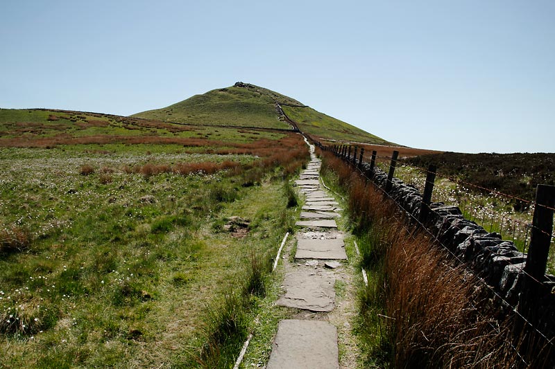
Located within the Cheshire boundary of the Peak District is Shutlingsloe, the counties third highest peak with an elevation of 506m (1,660 ft). Its often referred to as the Cheshire Matterhorn due to its pyramid-like summit which juts out of the surrounding landscape. The comparisons however stop dead in their tracks beyond its moderate visual likeness to the Swiss alpine giant!
The peak is situated close to Macclesfield forest and the village of Wildboarclough – purportedly where England’s last wild boar was killed.
The approach to Shutlingsloe is a moderate ascent from all directions, at the summit there are great views of Cheshire and beyond.
Shutlingsloe Short Circular Walk: This 4 mile circular route starts from Trentabank reservoir and heads up through Macclesfield forest to Shutlingsloe.
Delamere Forest
Delamere Forest is a vast area of woodland situated in the heart of Cheshire. Its landscape of deciduous and evergreen trees, bogs and lakes is interspersed by a network of undulating walking trails. The high-point at Delamere is called Pale Heights (176m), it sits atop Old Pale Hill and offers expansive panoramic views. Notable landmarks are identified by metal plaques within a stone circle at the summit itself.
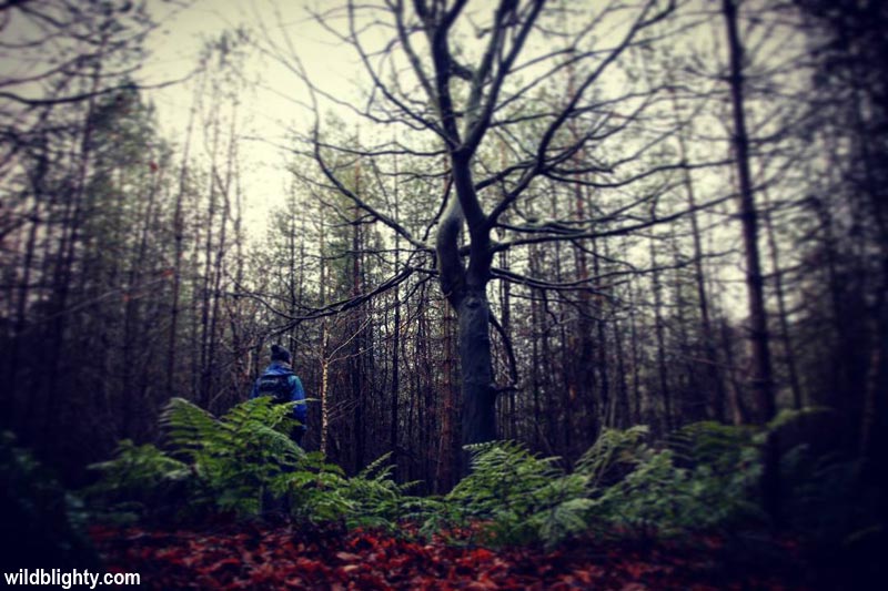
Short way-marked walking routes starting from the visitor and cafe complex will introduce you to the forest. Wander beyond these routes and you will find miles of forest paths sprawled under the forest canopy. Head off the main fire-roads to find solitude, observe the diverse flora and fauna or setup your hammock for an afternoon snooze! The onsite cafe serves tasty breakfast and lunch dishes, using locally sourced ingredients where possible. On the edge of the forest The Carriers Inn is a pub by Hatchmere lake, a small nature reserve which allows overnight fishing.
Getting there: Sat Nav postcode is WA6 6NZ, or Delamere Train station (a short walk from the visitor centre) is on the Mid-Cheshire Line, with trains running from Chester and Manchester.
Parking: Free layby parking along Ashton Road, Whitefield car park is pay and display or you can park at the visitor centre by Old Pale Hill – also pay and display.
The Sandstone Trail
The Sandstone Trail is a long-distance footpath stretching 34 miles (55 km) from the market town of Frodsham in Cheshire to Whitchurch in Shropshire. The trail is undulating with approx 1,000 metres (3,000 ft) of ascent in total, and includes sandstone ridges, woodland, farmland and canal towpaths. Amongst the highlights along the route are Delamere Forest, Beeston Castle and Peckforton Castle.
Typically walkers will complete the walk in 3 days, although if you’re fit its easily doable in 2 with an overnight stop in Beeston or Tattenhall. The starting point for the trail is signified by a distinctive sandstone obelisk situated outside the Bears Paw pub, a 3 minute walk from Frodsham train station. Incidentally there is also a train station in Whitchurch so you can do this walk car free. Full route details on the official sandstone trail website.
The Delamere Way
Discover rural west Cheshire on foot by walking or trail running the 21 mile Delamere Way long distance walking route between Warrington and Frodsham via Delamere Forest. Full details on my Discovering the Delamere Way page.
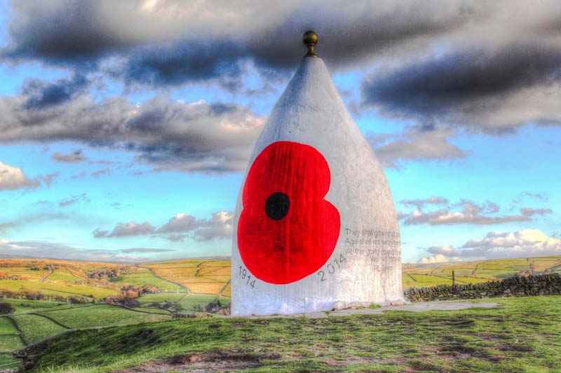
White Nancy (Kerridge Hill)
Situated above the Cheshire town of Bollington is Kerridge Hill (313m / 1027ft) and the feature landmark of White Nancy. The distinctive 5 metre high cone shaped structure is located on the ridge of the hill, which forms part of the Gritstone Trail long-distance footpath. Extensive views from the ridge include the Cheshire Plain, North Wales and Shropshire – making this a popular location for both walkers and photographers. If you have a few hours to burn this 3.5 mile circular walk starts in Bollington and includes Kerridge Hill. Once your done head to Cafe Waterside for a brew.
Helsby Hill
Helsby Hill (141m / 463ft) is a sandstone edge and popular viewpoint high above the village of Helsby in Cheshire. For a short wander you can first head up to the summit of the hill through woodland, which is signed from the free car park (postcode: WA6 9PT) and affords extensive views towards the city of Liverpool and North Wales. From the summit trig point you can explore below the cliff edge itself, if you are a climber there is some traversing and a few bouldering problems to check out – full details here.
Once you are done at the summit there are a few paths you can follow to extend the walk. Alternatively head back to the car park and drop down into Helsby quarry. Information boards provide an overview of the former quarry site, which is a mixture of woodland, sandstone rock faces and a rock tunnel which once housed a tramway used to transport sandstone down to the River Mersey.
For a longer walk incorporating Helsby Hill see my 7 mile Helsby and Frodsham circular walk.
Alderley Edge
Alderley Edge is a wooded sandstone escarpment situated close to the affluent town of the same name. Its popular for short woodland walks and boasts an impressive viewpoint of the Cheshire Plain and distant Peak District hills.
Explore the wood by following the way-marked paths which start from the National Trust car park (chargeable to non-members). Alternatively this 4.5 mile circular walks starts from Alderley Edge train station. Once your done head to The Wizard Tearoom or The Wizard Inn gastro-pub, both accessible from the car park. Note – the car park is off the B5087 Macclesfield Road by the pub itself, sat-nav postcode SK10 4UB.
What’s your favourite hill walk in Cheshire? Leave a comment below, I’d love to hear from you!