This epic Ogwen valley adventure begins with an assault of the iconic hunk of rock that is Tryfan, before tackling the giants of the Glyderau range – passing some of Snowdonia’s most recognizable landmarks, the walk concludes with a descent of Devil’s kitchen and a scurry back up the A5.
Distance: 10.8km (6.7mi) / Elev Gain: 1030m (3,380ft)
High Point: Glyder Fawr - 1001m
Map: OS Explorer OL17
GPS Download: Tryfan (Heather Terrace) and Glyders
Starting Point: ///encounter.unscathed.mild
Walk highlights include Tryfan (inc. Adam and Eve), Glyder Fach (inc. Cantilever stone & Castell y Gwynt), Glyder Fawr, Devil’s kitchen, Llyn Idwal and maybe a bloody great pasty !
[sgpx gpx=”/wp-content/uploads/gpx/Tryfan (Heather Terrace) and Glyders .gpx”]
With endless stories of Snowdonia parking woes and packed summits I headed to the Ogwen valley on a weekday, arriving early doors and somewhat jaded from the pre-dawn get up. To my great satisfaction I was to be greeted by a plentiful supply of parking spots, and thus positioned my car in a layby just below Milestone Buttress on the A5.
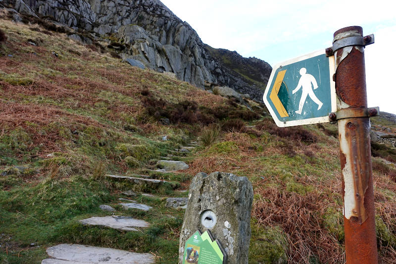
There’s little time to warm up on this route (bar a set of burpees next to the car!) as it’s straight into what is a prolonged yomp up Tryfan – over 2000 feet of elevation gain in just over a mile to be precise, initially via a rocky steep path on its lower north facing slopes. Having mistakenly crossed a stile not far into the route I traversed over a jumble of rocks, skirting left around the lower reaches of the main buttress. At one stage I was presented with a fairly easy looking scramble, and duly indulged with great vigour – reaching the top I did note this could have been avoided, though I was more than happy for some hands on action!
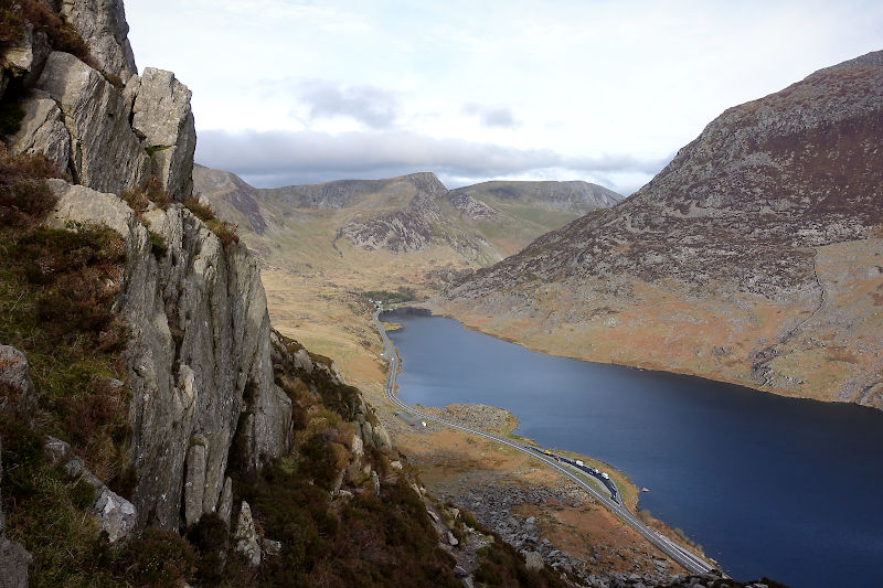
The view over my right shoulder looking down the Ogwen valley became increasingly more impressive the higher I got, cars were now mere dots in the distant landscape below.
The main ascent of Tryfan is via the Heather Terrace path which skirts around the East side of the mountain. Here sweeping elevated views looking towards Tryfan Bach (aka little Tryfan) and beyond were impressive, tents pitched at Gwern Gof Uchaf created an indistinct patchwork of colour. The terrain was a mixture of rocks, boulders, scree and grassy paths – the latter making up some (but certainly not all) of the Heather Terrace path – which is not as ‘pathy’ as one might imagine, and does call for some hands on action – though nothing strenuous (for me anyhow).
About half way along the Heather Terrace path I bumped into a climber (not literally), deep in concentration belaying there partner high above – we exchanged pleasantries and I continued on my way. I recall small birds (species unknown!) tweeting away, intermittently punctuated by the distant hum of the A5 (or perhaps the cascading waters of Nant Gwern y Gof below). Glyder Fach was now visible (although shrouded in cloud) and as it became more prominent the breeze slowly picked up and the gradient lessoned, a sign I was reaching the conclusion of the path.
The Heather Terrace path eventually leads to Tryfan’s South ridge, I transitioned to the ridge via steep scree and a stile – although not before becoming a little disorientated as to the ‘proper’ way to go.
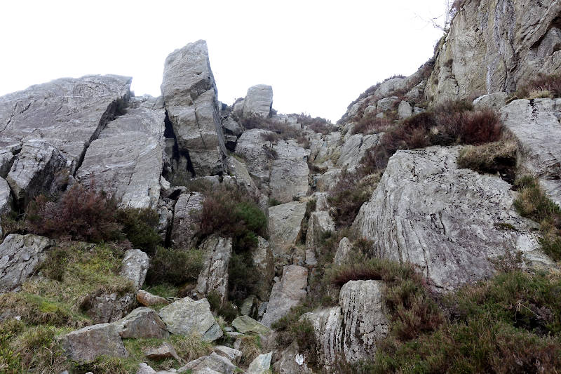
The scramble to the summit of Tryfan is via a jumble of blocky boulders, and with no obvious path it’s a case of identifying natural weaknesses in the rock formations and picking your line, not taking any undue risk and of course having fun! Having said that just shy of the summit I did take on an exposed semi-crawl type manoeuvre, which nearly ended in disaster when a fighter jet came booming by overhead (seemingly out of nowhere) – and scaring the heck out of me! I assumed this was a training flight from RAF Valley on Anglesey.
I had Tryfan’s boulder-strewn summit to myself and over indulged with my camera, taking in the far reaching elevated views down the Ogwen valley. I stared at the twin rock monoliths of Adam and Eve thinking to myself that one day I should take on the exposed step/jump between the two – though with a plethora of excuses (including a distinct lack of tread on my north face walking shoes) swiftly determined today was not to be the day I take that risk!
Returning down the South ridge I consciously avoided the aforementioned crawl manoeuvre, sticking more to the right side (West) with Llyn Bochlwyd in full majestic view – incidentally I noted the lakes uncanny resemblance to that of Australia (as viewed on a map)! – highlighted during my route research the previous evening. Similar to the earlier ascent, the way down is not obvious and I did end up backtracking a couple of times – and was happy to reach Bwlch Tryfan unscathed though aware the walking was about to get tough once more.
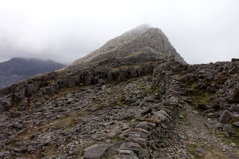
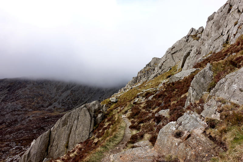
The days low cloud base was evident as I stared towards an eerie Glyder Fach. The ascent was super steep over a mix of slippery scree and rock, and I hung left of the main buttress (thus avoiding Bristly Ridge) – my heart racing the higher I got. A minor rockslide gave me notice of a couple descending ahead – soon enough their bright mountain gear coming into focus. The way narrowed as I edged towards the top, the going was easier now however visibility was deteriorating.
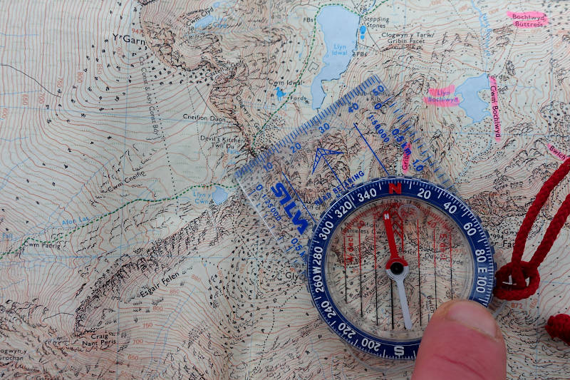
A cairn marked the beginning of the Glyder Fach summit plateau, by now the views were non-existent! According to Wikipedia ‘Glyder’ can be roughly translated to mean heap of stones, and given the terrain underfoot I couldn’t disagree. After a quick GPS check and a compass bearing (I needed to head west) I began to pick my way over the uneven rock-strewn surface, initially continuing on an upwards trajectory.
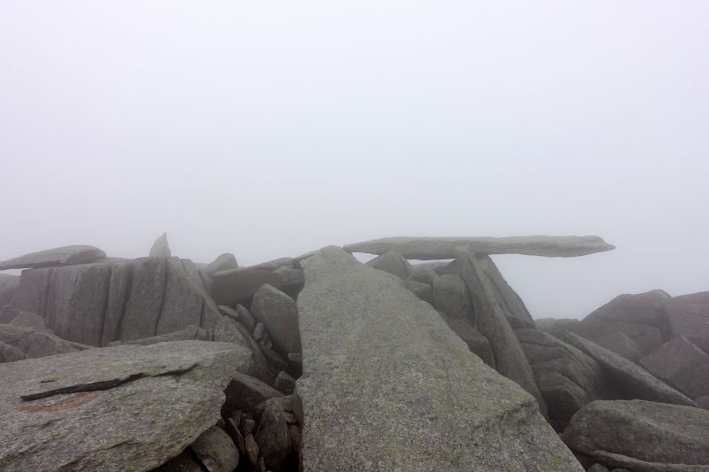
A prominent feature on Glyder Fach is The Cantilever stone (Y Gwyliwr), a seemingly precariously balanced slice of rock jutting out into the ether. I’ve previously witnessed groups of walkers lunching out on the stone itself, and of course its no doubt right up there on the Instagramability scale too. However today there wasn’t a soul about, the wind was now considerable and with little hesitation (or indeed a sandwich stop) I was once again traversing the monochrome landscape.
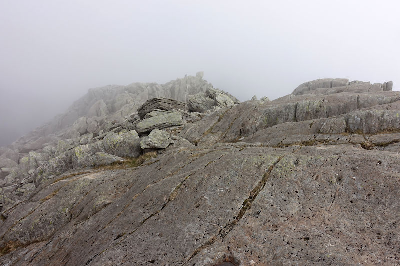
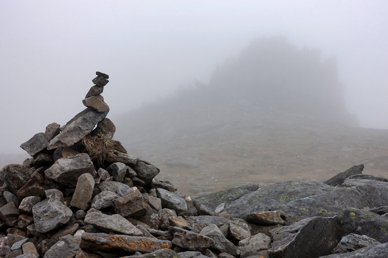
Castell y Gwynt is another prominent feature on Glyder Fach, and is itself classed as a Nuttall. The normally impressive rocky outcrop, somewhat akin to Superman’s Fortress of Solitude?, was not so impressive today – as per my image I could just about make it out! That said it did reassure me as to where I was on the map, and I was soon making good time on the narrow stone path traverse towards Glyder Fawr.
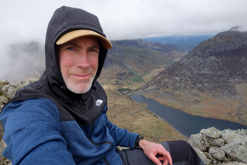
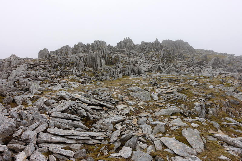
The main highlight on Glyder Fawr was that of the cloud starting to shift, the view down towards Llanberis (and I reckon over to Snowdon) was impressive – and a reminder of the many routes into these mountains. The rocky outcrops (and bonkers rock formations) came thick and fast, and with much improved visibility this section of the walk was most enjoyable.
I treated myself to a summit selfie (which without a GPS I’m not sure I’d have located) and a compressed lukewarm egg sandwich, took another compass bearing (this time for practice rather than necessity) and exchanged pleasantries with three fellow walkers – the first talking mammals I’d encountered for some time!
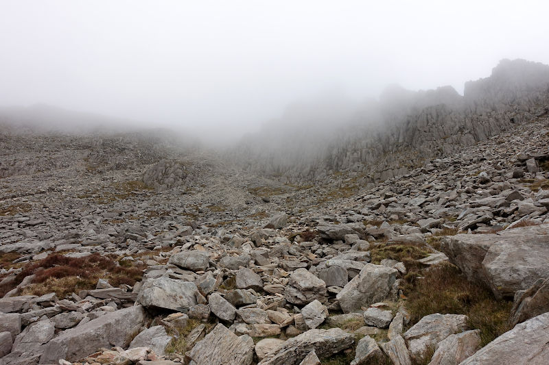
An option on this route is to extend the walk up to Y Garn, and I did contemplate it for all of 2 minutes. A time check confirmed I’d be pushing my luck (and risking the wrath on my wife!), though to be honest my legs were by now pretty shot – I clearly wasn’t as mountain fit as I thought on this occasion! My third and final excuse was I’d been up Y Garn just 12 months previous, with my 8 year old, and the ordeal was still fresh in my mind (turns out he wasn’t quite as ready for the challenge of a proper mountain as I thought)! Thus with no hesitation I began the steep descent, sliding down sections of scree, towards Devils kitchen.
The Devil’s Kitchen route down to Llyn Idwal is one of the most enjoyable mountain descents I can think of. Stunning views over towards Pen yr Ole Wen provide the backdrop to an airy and steep stepped route down. I slid down or down climbed a few small sections, and generally had a great time – stopping frequently to look at and feel the atmosphere this place seems to project. This was one of the highlights of the day for me.
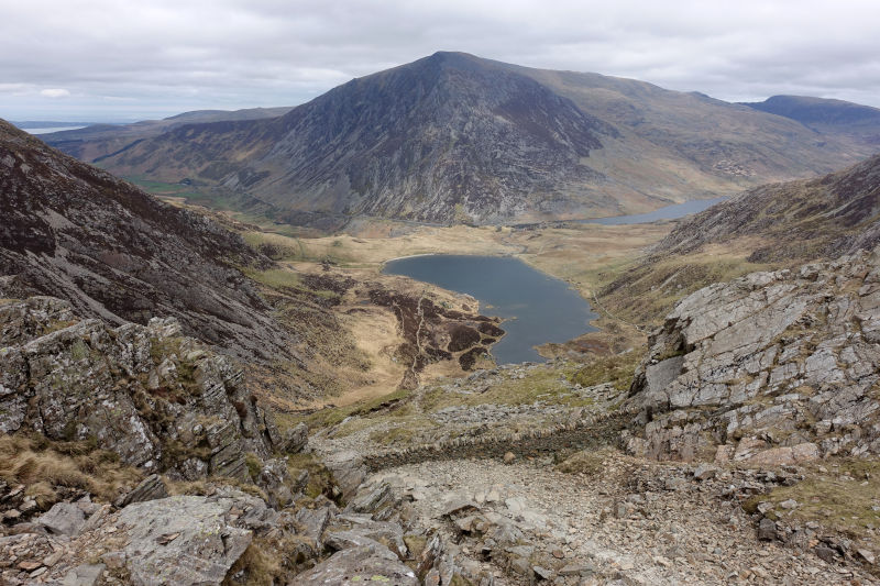
As I reached the far side of Llyn Idwal the concentration of people increased significantly. Edging past the crowds I felt somewhat claustrophobic, and thus increased the pace. I was cream crackered by now, and distinctly remember this section of the walk seemingly taking an age. I crossed the foot bridge downstream from the lake, which was a hive of digital activity, and soon enough arrived at the Ogwen Snack Bar – devouring a sumptuous locally produced pasty and lemon San Pellegrino with great gusto!
All that was left was a power walk along the A5. I crossed over the road to be by Llyn Ogwen, and an uneventful 10 mins later was back where I started – soon on my way back to the real world once more !
Hazards
This is a very rocky route and sections of scrambling are unavoidable, in the wet rock can become very slippy – both underfoot and in terms of grip. Navigation could be tricky in poor visibility, and on the summit of Tryfan you may encounter exposure – especially if you climb Adam & Eve.. Not recommended as a winter route unless you are an experienced winter mountaineer.
Remember – we cannot highlight all potential hazards when out in the great outdoors. Safety is ultimately down to you. Educate yourself in safety, weather reports, navigation and equipment specific to the activity you intend to undertake and conditions/terrain you may encounter! Check out adventuresmart.uk for general outdoor safety considerations – and activity specific guidance for hill walking, paddle boarding, mountain biking and open water swimming.