Experience the thrills of the Dark Peak on this epic cross country mountain biking loop. This gear-grinding mixed terrain route is for experienced and fit mountain bikers comfortable with technical climbing and fast rocky descents (‘proper’ DH trails are avoided!). The route takes in some of the most iconic trails and tarmac in the area, if you only get to spend one day in the Peak District this is the ride for you!
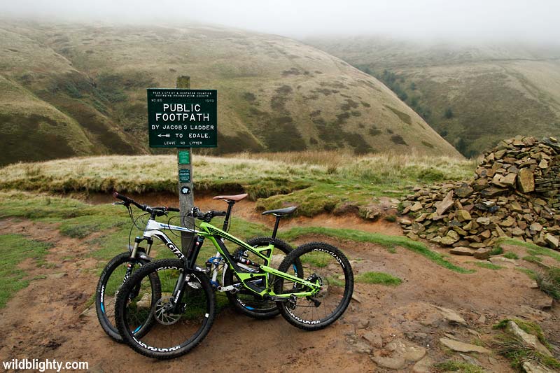
View from the top of Jacobs Ladder with Edale in the distant background.
Approx Time: 5 – 7 hours
Navigation: GPX Download – Map
Starting point: Buxton Road, nr Castleton
Sat Nav (nearest postcode): S33 8WP
For a less energetic ride check out our shorter blast route
Note – This ride is on typical Peak District terrain, a mixture of multi-use rocky paths, bridleways and tarmac. The drainage is limited to non-existent in places, as such we don’t recommended doing the ride after prolonged periods of heavy rain.
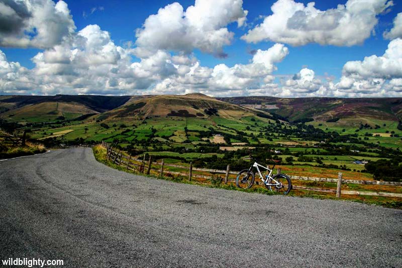
The infamous super-steep tarmac ascent of Mam Nick from Barber Booth.
Ride Guide Details
- From the starting point at Buxton road head back on yourself and then take a sharp right onto Arthurs Way.
- The tarmac road leads to Winnats Pass, an iconic and lung-bustingly steep climb!
- At the T-junction turn right and follow the road around a left-hand bend. You will see Mam Tor on your right (and possibly some paragliding activity).
- Just beyond the Mam Nick National Trust car-park take a right up the steep tarmac road, signed Barber Booth and Edale.
- After approx 100m the road crests the hill. Drop down the hill and look out for a gate on the right as the road bends to the left. Go through the gate and take the fork on the right, this muddy path traverses below the summit of Mam Tor.
- The muddy path eventually transitions into stone slabs, known to some as the yellow brick road! Keep going until you arrive at Hollins Cross, an unmistakable intersection of multiple paths within a natural bowl.
- Turn left in a NW direction to begin the descent to Edale. The trail soon forks, go left again and descend for approx 0.5 a mile until you join a small road.
- Go right on to the road, continuing the descent towards Edale. You will arrive at a T-junction, if you want a cafe stop go right then left, following the signs for Edale. Otherwise go left on the tarmac road.
- After approx 0.8 miles you will cross a stone bridge (crossing the River Noe) as the roads bends to the left. Go right down the lane immediately after the bridge.
- Follow the lane for approx 1 mile, passing a car park on your left and Upper Booth farm/campsite on your right. You then naturally join the Pennine Way. You will soon arrive at a gate, with splendid views ahead (see below)
- Go through the gate and continue on to Jacobs Ladder which is well signed. At Jacobs Ladder you can attempt to ride the rocky path that zig-zags left then right, or carry your bike directly up the steep rocky path to the right, which is Jacobs Ladder itself.
- From the top of Jacobs Ladder we are aiming for Hayfield, approx 3.5 miles away. Continue on in a Westerly direction sticking to the main path. This is an exposed area with dodgy phone signal and little in the way of landmarks. It would be sensible to have an offline map and compass handy for this section.
- After approx 2 miles you will cross a river. Keep heading in a Westerly direction with the river on your left.
- Follow the path around to the right, and take the left hand fork. After approx 0.5 miles you will see Hayfield campsite through the trees on your right.
- You will now be riding adjacent (on the right) to the River Sett. The trail leads onto Valley Road. Continue on to the end of Valley Road.
- For a cafe stop head right and right again onto Church Street and into the centre of Hayfield.
- At the end of Valley Road go left onto the steep Highgate Road – this is a bit of a slog!
- After approx 1 mile take the loose stone path on your left, opposite the farm buildings.
- Continue climbing in a North-Easterly direction along the Pennine Bridleway. You will pass below the summit of South Head (to your right).
- Stay on the Pennine Bridleway for a further 3 miles, heading in a North-Easterly direction all the way to a main road (Sheffield Road).
- Go left on the trail just before the junction with Sheffield Road, then continue on through the gate onto Rushup Edge, a rocky/muddy path which runs adjacent to Sheffield Road.
- Continue on Rushup Edge for 2 miles, the path will fork – take the well defined stepped path down to the right which leads to the same road you climbed earlier.
- Turn right down the road and at the T-junction turn left, continue along Sheffield Road around the right-hand bend and past the turning for Winnats Pass (on your left)
- You now pick-up the XC Blast route, which has detailed instructions covering the next 11 miles, starting by taking a left through a farm gate towards Rowter Farm.
- Fast forward 11 miles and we pick up again at the stone bridge we crossed earlier, beyond Edale at Barber Booth. This time instead of turning right head straight up the tarmac road. This is a gear-grinding 1 mile climb which twists its way up to Mam Tor once more. Its known locally and on Strava as both the Mam Nick or Mam Tor Hill Climb.
- Continue over the top of the climb back down to the T-junction with Sheffield Road you will now be familiar with.
- Turn left then take your next left onto the tarmac road signed Blue John Cavern. This is a tarmac road, go down the road past the cafe until the tarmac runs out
- Go through the gate and join the ‘Broken Road‘, a sweeping fast descent which leads you back to the starting point.
- An epic ride i’m sure you would agree! Get in touch and tell us what you thought!